
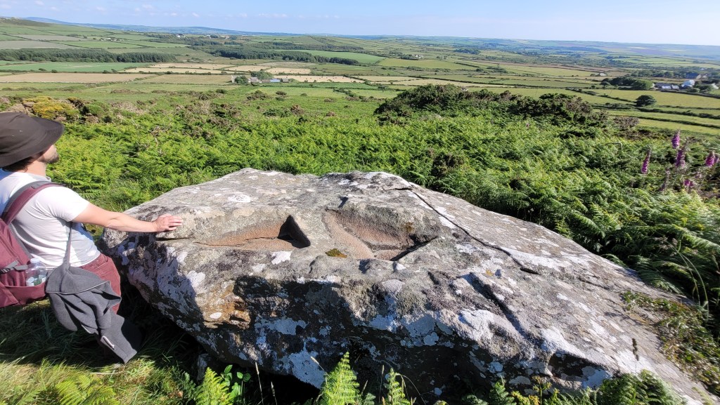
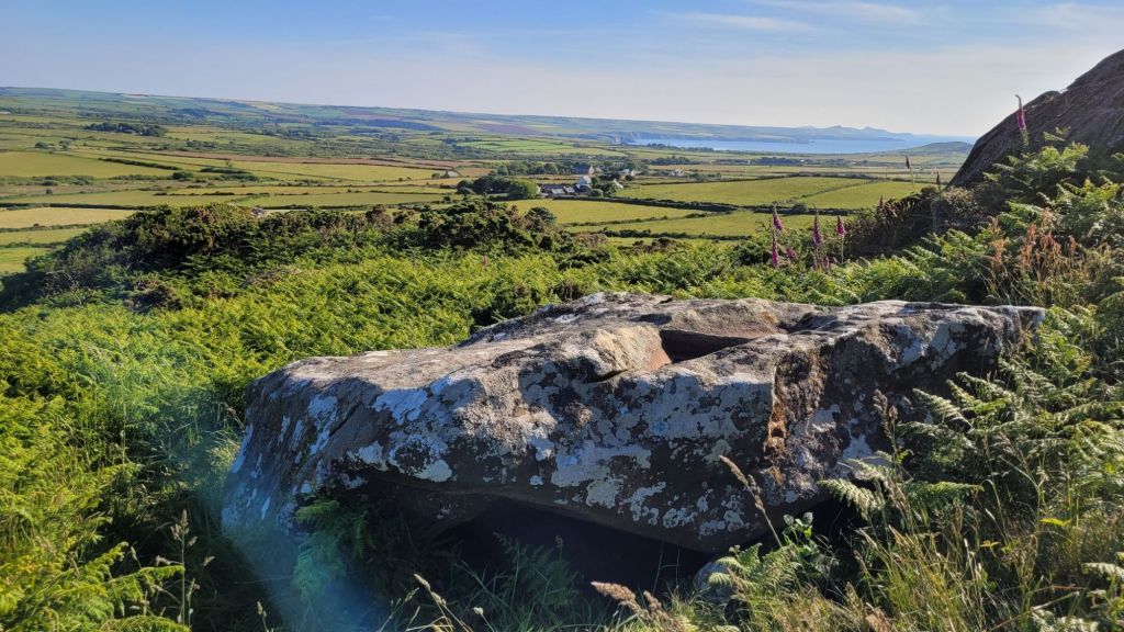
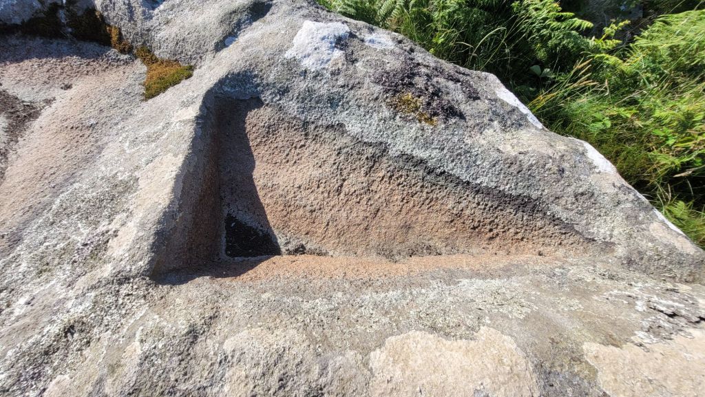
Strumble Head in Pembrokeshire, Wales is home to numerous neolithic remains. On the rocky hill named Garn Gilfach sits an interesting monument classified as a ‘chambered cairn’.. Upon the capstone are triangular markings which have sparked much curiosity..
We parked our car near the red arrow.. However, the public footpath that goes up the track to Gilfach Farm is a much more direct route.

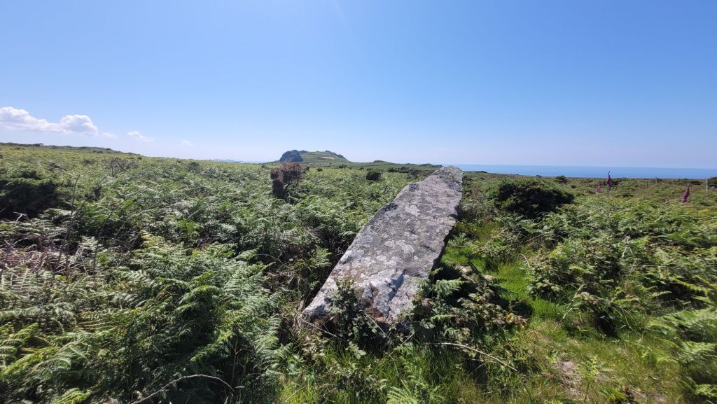
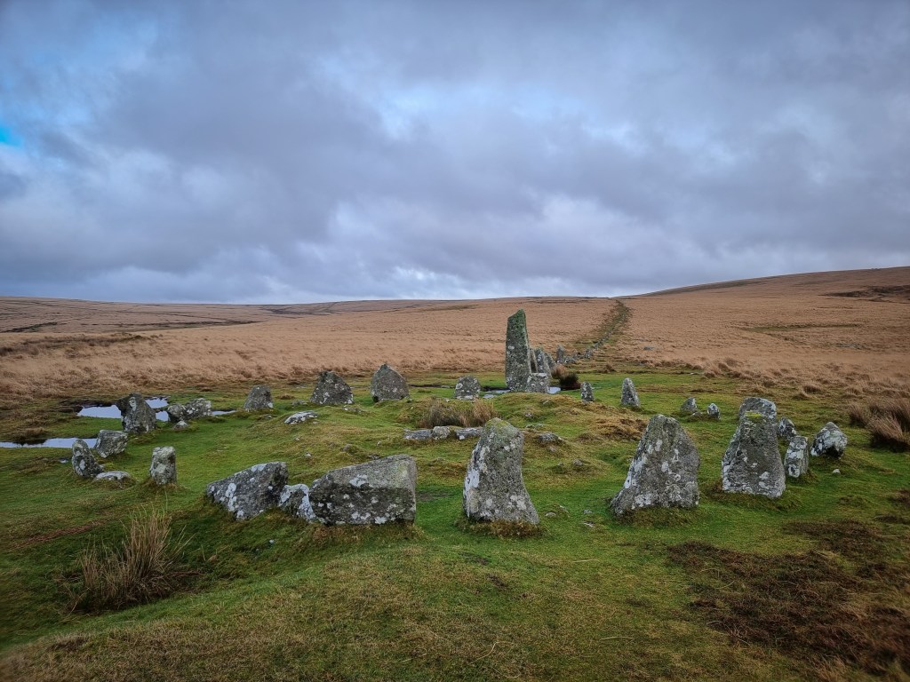
We followed the public footpath to ‘Lady’s Gate’. Although no longer standing very upright, it is labelled as a standing stone on OS maps and is sometimes referred to as Lady’s Gate Standing Stone or Garn Gilfach standing stone. According to CADW, it is “said to have been one of two c.300yards apart, flanking “a gate on the high road” called the Lady’s Gate.” The view from up this side of the hill are amazing, so it is definitely worth the detour if you have time..
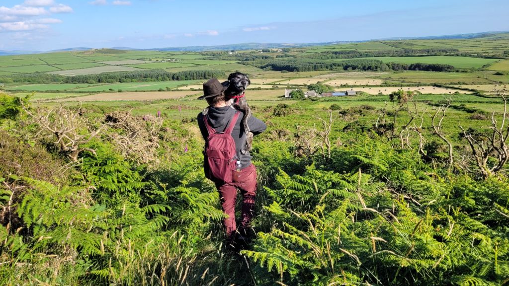
We retraced our steps back around the hill and headed towards the cromlech.. The paths were very overgrown, but thankfully Zeb quite enjoys being carried..
Richard Fenton’s account from ‘A Historical Tour Through Pembrokeshire’ written in 1810, is as follows:
“The side to the west of Carn Culhwch seemed to have been appropriated to druidical ceremonies from the many Cromlechs, some overturned, and some in their original position. There is one more remarkable than the rest; a large unshapen mass of serpentine, fifteen feet by eight, and two and a half average thickness; under the edges of it are placed nine or ten small pointed upright stones, imbedded in a strong pavement, extending for some way round. These small supporters are fixed without any regard to their height, as only two or three bear the whole weight of the incumbent stone, one of which is so pressed by it, as to have become almost incorporated with it.
On the upper surface of the Cromlech are three considerable excavations near the centre, probably intended to have received the blood of the victim, or waters for purification, if (as it is the most general opinion) they were used as altars… this stone has a small inclination to the north-east. Its height from the ground is very inconsiderable, being scarce one foot high on the lowest side; and on the other only high enough to admit of a person creeping under it, though once entered, the space enlarges from the upper stone having a considerable concavity.
The earth below is rich and black. ..(I have since learned that the blackness I refer to, appears to have been chiefly the effect of fire, as many bits of charcoal and rude pottery have been picked up there.” – https://archive.org/details/b22013179/mode/2up?ref=ol&view=theater

It seems the early records at the site by Richard Fenton may have peaked interest in contemporary and future antiquarians.. In 1872 Edward Lowry Barnwell wrote about this site and commented he was thankful that Fenton had left a considerable amount of notes regarding it.
The following was published in Archaeologia Cambrensis, in 1872.. Titled ‘On Some South Wales Cromlechs’, Barnwell refers to this monument as Gilfach Goch…
“Proceeding onwards, towards Strumble Head, the cromlech-hunter will find one at a place called in the Ordnance Map Gilfach Goch, a view of which will be found in the Plates. It is of unusual character in having its capstone supported on a row of low stones,—so low that none but a very slender man, lying flat on the ground, could insinuate himself underneath. The capstone is nearly 14 ft. long, 8 wide, and 2 ft. thick, while all around are lying the relics of the former earn or tumulus.
Mr. Blight did succeed in getting under the stone, but found only a fragment of flint, which must have been placed there, as there is no natural flint in the country. It is also difficult to imagine how this grave could have been available for secondary interments, as the usual means of access to the interior do not exist…
…A farmer informed Mr. Fenton that two or three years before his visit two spear-heads were found, laid across each other, and a knob of metal, suspected to have been gold. Another cromlech is given in the map as at Pont Iago, but it could not be found on the occasion of this visit. It may still be there, concealed among the heath, if it is of the same low character as that at Gilfach; or it may have vanished altogether, in the usual manner. It could not, however, be found on the occasion alluded to, after a diligent search; nor does Fenton seem to have known of it,—at least he does not mention it.” – https://journals.library.wales/view/2919943/2999961/61#?xywh=-330%2C374%2C2898%2C1860

The monument is set beneath the southern side of a rock outcrop close to Garngilfach and it’s thought that the capstone was raised by undercutting and underpinning a natural boulder.. The close proximity to a rocky outcrop is also a familiar feature at a subsection of these sites. But was this positioning simply chosen for convenience, or is the outcrop used as some sort of dramatic backdrop? In 1936, archaeologist WF Grimes said that “Some ancient sites are linked together not so much by the possession of chambers of similar form as by their choice of position. Outcrops of igneous and other rocks have been chosen by the megalith- builders as the sites under which to build burial chambers”
In 2004, Cummings and Whittle argue that restricted visibility is a common feature among this group of monument. – loosely classed as sub-megalithic – The authors compare these restricted view megalithic constructions with other types of monument of comparable age elsewhere in the UK, such as henges, which usually have a more or less unrestricted view all round, and suggests that selecting a location which created a strongly one directional outlook was deliberate and possibly meaningful.
In a publication from 2007, archaeologist and rock art specialist George Nash groups this monument as one of ten Neolithic sites on Strumble Head that appear to conform to a number of architectural and landscape rules.
“This cluster includes the group at Garn Wen, Carn Wnda, Parc-y-Cromlech, Ffyst Samson, Carreg Samson, Ffynnondruidion and Garn Gilfach, nearly all appear to conform to the same architectural rules and landscape positioning, each monument embracing the fertile lowlands north and south of an east-west upland ridge, which straddles Strumble Head. Excluded from the list, but forming part
of the discussion is the destroyed monument of Y Garn, which once stood between Garn Gilfach and Carn Wnda.”.
Here is the video we made covering the history and archaeology of Garn Gilfach –
George Nash publications:
https://www.researchgate.net/publication/250172912_Encoding_a_Neolithic_Landscape_The_Linearity_of_Burial_Monuments_along_Strumble_Head_South-west_Wales
https://www.rockartscandinavia.com/images/articles/a19nash.pdf

Leave a comment