

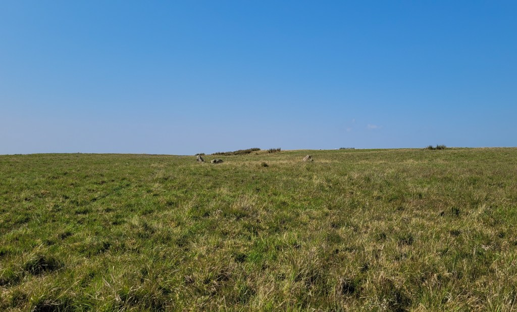
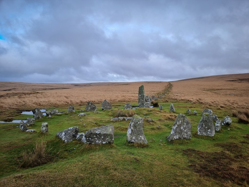
Bronze Age stone circles near the village of Trecastle, situated on the edge of Parc Cenedlaethol Bannau Brycheiniog in Powys, Wales.
The mountain is known for its Roman remains, including marching camps and a Roman road. There are also the remains of Iron Age structures, stone alignments as well as the Bronze Age stones circles. Below is the OS Map Courtesy of Ordnance Survey ©2025 Microsoft – https://www.bing.com/maps/?cp=51.959589%7E-3.677192&lvl=13.5&style=s – (To view on mobile, turn on desktop mode in your browser settings)

The following is the description of the site from Coflein.gov.uk:
“Two quite irregular stone circles: at SN83353109, about 75′ in diameter, composed originally of c.30 stones, at most 2′ high, with those on the S, where an entrance is suggested, being the tallest; at SN83313106, about 25′ in diameter, originally made up of c.10 stones, with five or six, up to 3’6” high, surviving.
These circles are not considered to represent the remains of funerary mounds, but have been integrated into a general discourse of ritual circles, thus short lengths of stone alignments, adjacent or nearby (at SN83413101) can be interpreted as ‘stone rows’ rather than as the remains of field boundaries, and a large fallen stone to the SE (SN83393107) is seen as marking the midwinter sunrise from the larger circle.
(source OS 495 card: SN83SW6) J.Wiles 04.04.2002
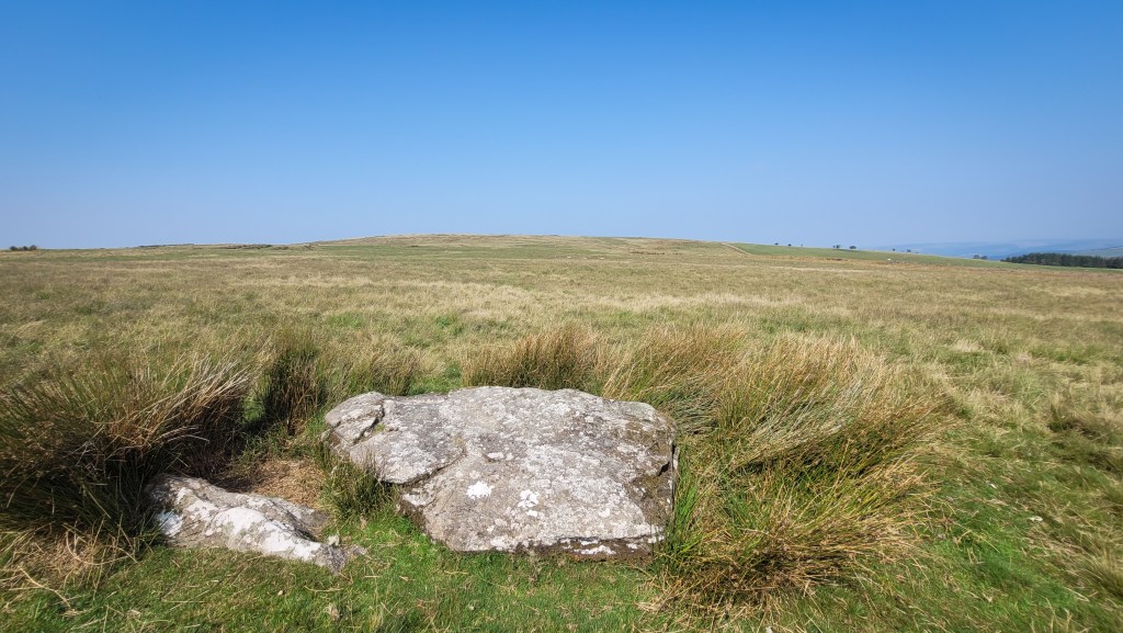
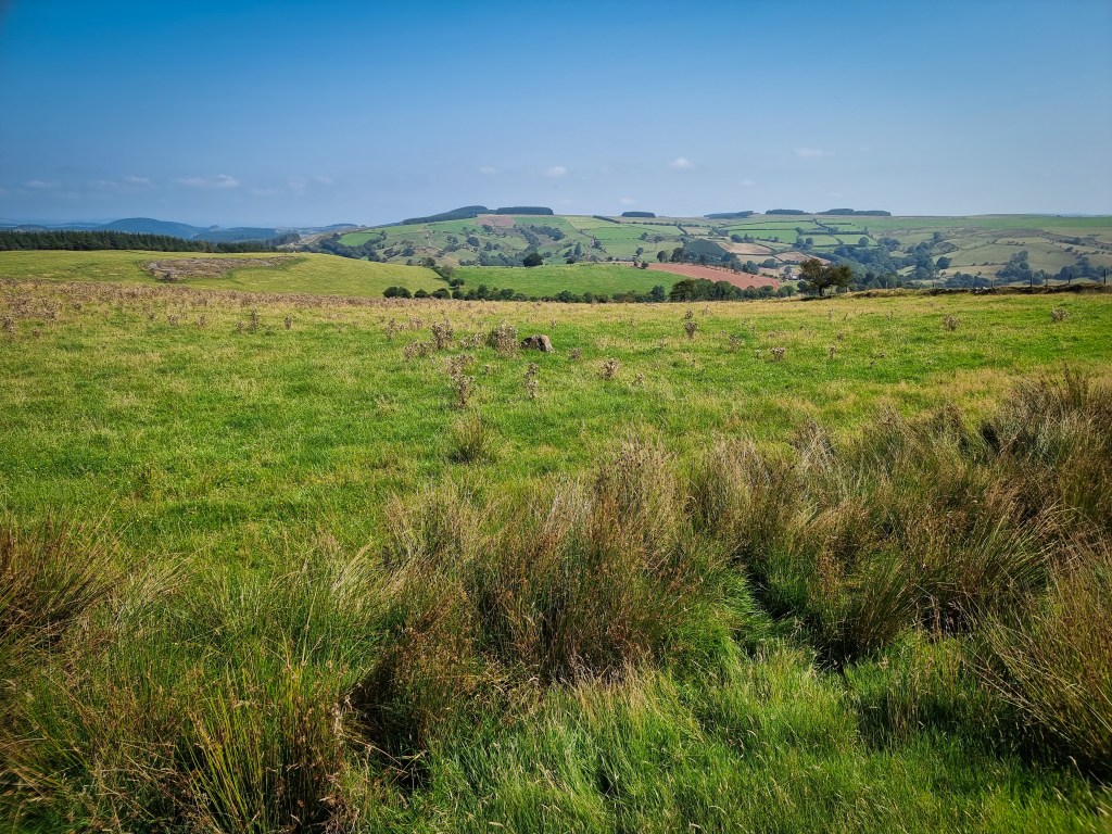
The larger of two stone circles on Trecastle Mountain, on an undulating plateau sloping gently to the north at 370m ASL. It has a diameter of 23.1m (NE-SW) by 22m and consists of 21 upright or leaning slabs and blocks of local sandstone. They vary in height from 0.1m to 0.5m. The stones have a regular spacing of about 2.6m with at least five stone holes visible around the circuit.
A low swelling is visible at the centre of the circle, 6m-7m diameter, perhaps the remains of former infill, or the capping of a burial. However, local peat cutting may have led to the creation of the mound (OS record card). A smaller circle lies a short distance to the south-west (NPRN 413022).
Brecknock Inventory (i), 1997, p.153-5. David Leighton, RCAHMW, 14 February 2011″ – https://coflein.gov.uk/en/site/104135/
Aubrey Burl discusses the monuments here and nearby. The following is quoted from his book, ‘The Stone Circles of Britain, Ireland and Brittany’:
“Three and a half miles NNE of Nant Tarw across the Usk valley, near a Roman road and camps are two more rings on Trecastle Mountain, again dissimilar to each other. The ENE is 23.2m across, of inconspicuous stones with an off-centre mound inside it. Close by the second much smaller ring, only 7.3m in diameter, is ruined and incomplete. To its WSW is a wretched short alignment crawling towards the circle, its stones just perceptible in the wet ground. Even allowing for a rise in the ground level it is unlikely that such a setting could have been laid out for astronomical purposes. It is significant that although proposing three solar sightlines in these rings, his ‘Y Pigwn’, Thom overlooked this ‘row’ altogether..”
https://archive.org/details/stonecirclesofbr0000burl/page/182/mode/2up?q=trecastle
The outlying stones nearby the circles:

Leave a comment