
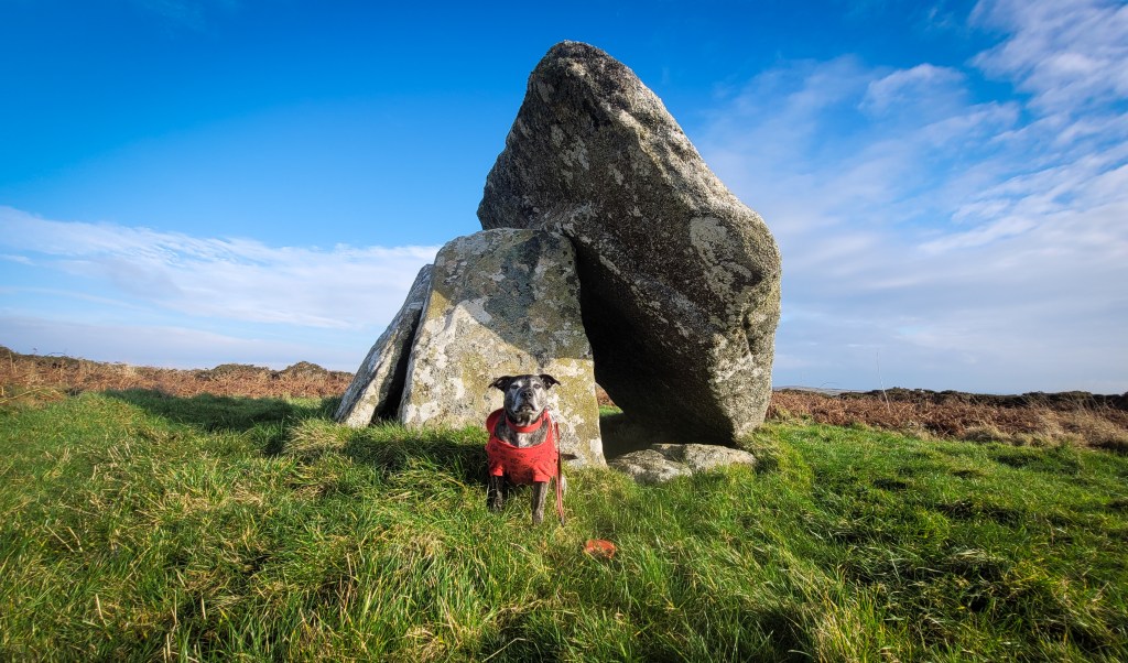
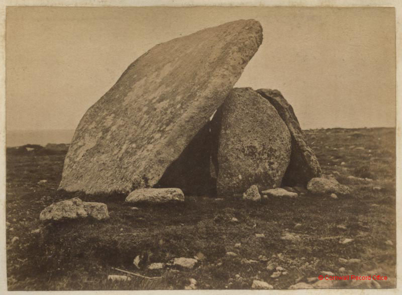
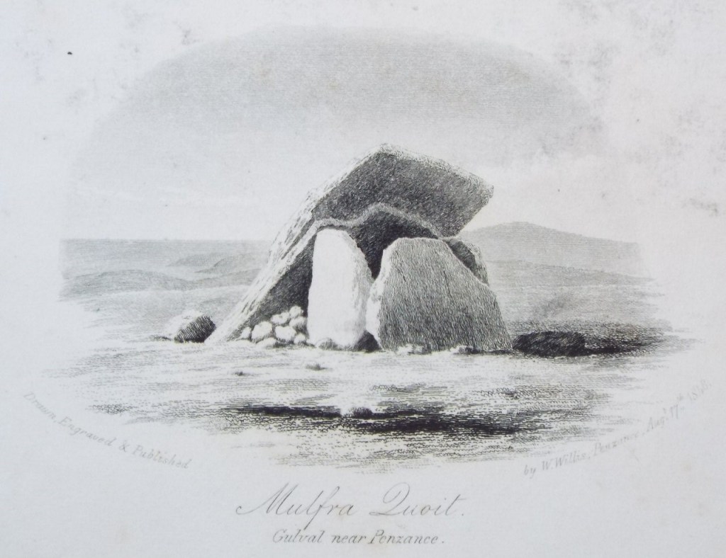
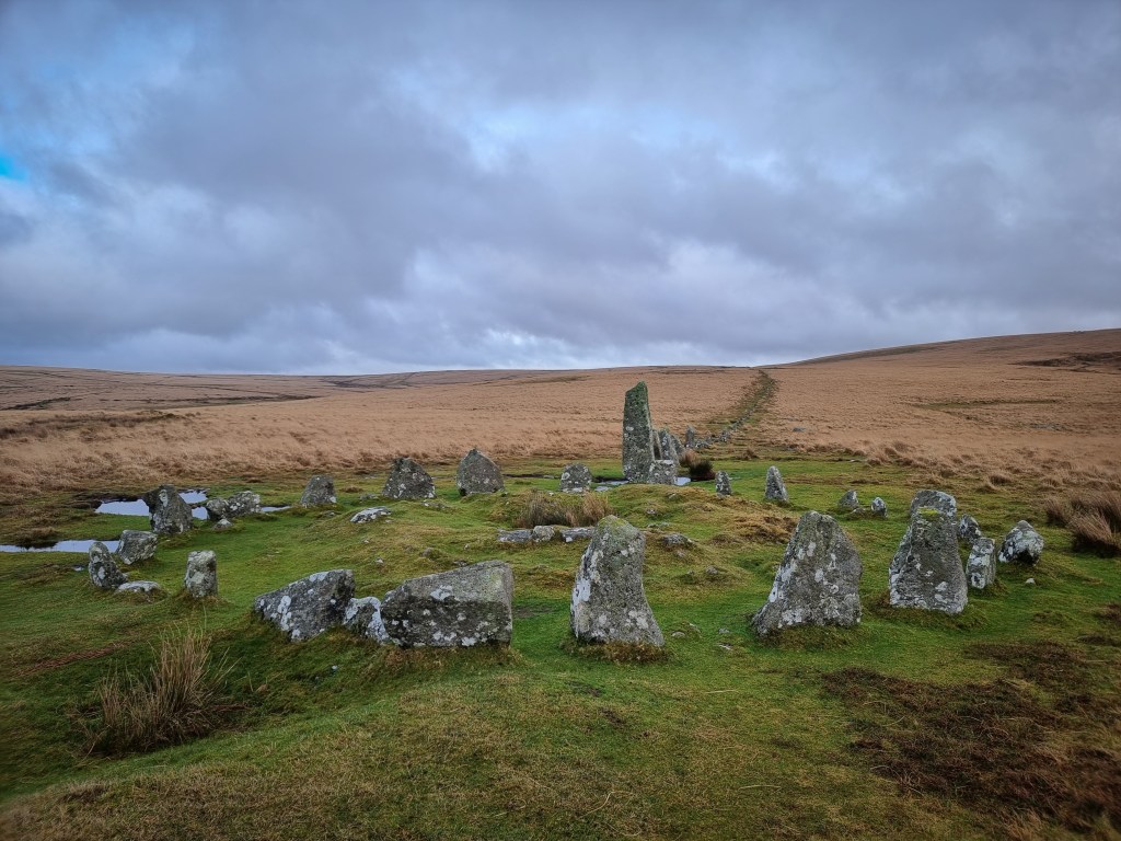
Neolithic cromlech on Mulfra Hill, Cornwall.
It is unclear when the 5 tonne capstone slipped. There was a local story that the capstone fell during a thunderstorm in 1752. However, in the 19th century, antiquarian William Copeland Borlase confirms his great-great-grandfather, William Borlase had recorded the site in the same state as far back as 1749. Borlase had excavated within the chamber and discovered a 20 inch pit at the centre, and found “that something which either was originally, or has since turned black, was placed at the bottom of it.” It is most likely that the capstone fell due to the removal of the southern supporting stone.
Antiquarian records of the site:
The following is quoted from ‘Antiquities, historical and monumental, of the county of Cornwall’, by William Borlase in 1769:
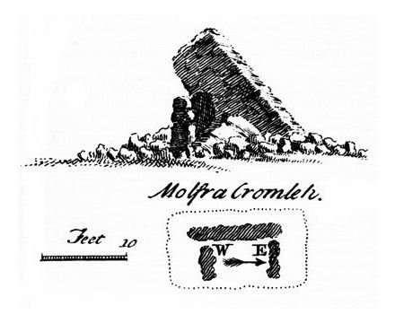
“In the parish of Madern (Cornwall), there are two Cromlehs ; one at Molfra, the other at Lanyon. The former is placed exactly on the summit of a round bald hill, as the word signifies in the Cornu-british. The Cover-stone is nine feet eight by fourteen feet three inches, reckoning a piece evidently clove, or broke off from it, and lying near it. The supporters are three, five feet high, inclosing an area six feet eight from east to west, and four feet wide, so that the length bears due east and west, has a side stone to the north, but is open to the south, that stone being probably removed, or broken into pieces. This quoit was evidently brought from a Karn or Ledge of Rocks below, about a furlong to the north west, in which karn may be seen several very large flat stones lying on one another horizontally ; and some thin ones, near the top, seem by their parallel edges to have been raised or clove off from the rock underneath by art, as if on purpose to form more cromlehs ; those that did not rife well serving for supporters, and the more entire for quoits, or covering stones. This stone-barrow with which this cromleh is surrounded is about two feet high from the general surface, and 37 feet three inches in diameter.
As this quoit is off from its ancient situation with one edge resting on the ground, I thought it might permit us safelt to search the inclosed area. In digging, one foot was very black, the natural upper soil ; we then came to a whitish, cinerous-coloured stiff clay, two inches in depth, then a thin stratum of yellow clay mixed with gravel, four inches deep ; then a flat, black, greasy leam, mixed in and throughout, more or less, with the yellow natural clay ten inches in depth, under which appeared the hard, natural, stony, stratum which lies on the karn, not moved since the deluge. The pit was 20 inches deep under the natural hill. Although here is not all the discovery that might be wished, yet the following truths may be deduced from this digging ; by the black greasy loam being got down under the two layers of yellow and cinereous clay, it appears that a pit was dug in the area of the kist-vaen ; that something which either was originally, or has since turned black, was placed in the bottom of the pit.”
– https://archive.org/details/bim_eighteenth-century_antiquities-historical-_borlase-william_1769/page/n5/mode/1up
The following is written by William Copeland Borlase, the great-great grandson of the previously quoted William Borlase, published in 1872 in
Nænia Cornubiæ, a descriptive essay, illustrative of the sepulchres and funereal customs of the early inhabitants of the county of Cornwall:
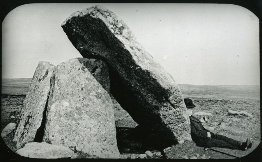
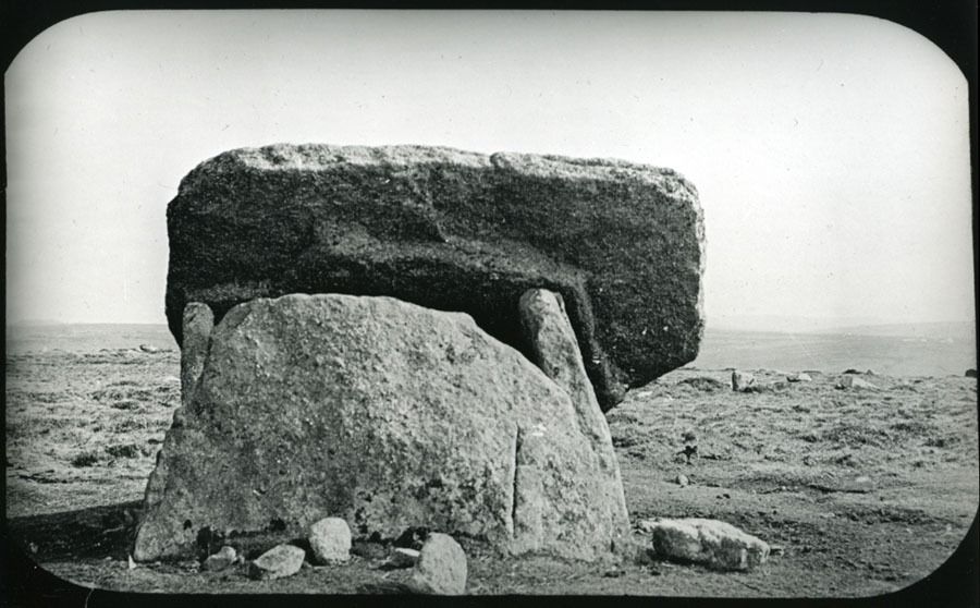
“This monument consists at present of three granite slabs five feet in height, forming the west, north and east sides of a kist 6 feet 8 inches long, i.e., from east to west, and four feet wide from north to south. On the southern side, instead of the fourth slab, a stone, which is supposed to have been once the covering-stone, rests lengthways and obliquely against the edges of the side stones. This stone, the lower end of which is now fixed in the ground, measured, with “a piece evidently clove or broke off from it, “in Borlase’s time, 14 feet 3 inches long, by 9 feet and 8 inches broad. At that time a stone-barrow, now entirely removed, measuring two feet high, and thirty seven in diameter, surrounded the monument.
There is little doubt that the removal of the southern supporter caused the overthrow of Mulfra Quoit. It might indeed be possible that the cap-stone was never actually raised to the position for which it was intended ; but the fact of a fracture having taken place in it, as well as the angle at which it now stands, which is precisely that it would have assumed had it been overbalanced and slipped from its place, presents no analogy to the case of Lower Lanyon, and confirms the suppositions that it is simply a fallen cromlech.
The author of the Land’s End District states that, he was informed that the date of its collapse was 1752, during a thunderstorm. He was, however, probably misled by an account published in the Philosophical Transactions of the year following, in which it is recorded that a “quoit” on Molfra Hill (meaning the highest stone of a natural pile of rocks, and often so called by the Cornish), had been struck by lightning in that year. Dr. Borlase visited the spot on the 23rd of October, 1749, and at that time the Cromlech was in precisely the same state as present. He says, “as this quoit is off from its ancient situation with one edge resting on the ground, I thought it might permit us safely to search the enclosed area.” Nothing of importance was discovered, and the Doctor only found that a pit had been sunk twenty inches deep in the area of the Kist-Vaen, and “that something which either was originally, or has since turned black, was placed in the bottom of it.”
In the winter of 1871, the author caused a low cairn of stones, about thirty feet in diameter, and two feet high, on the northern brow of the hill on which this cromlech stands, to be dug through. Pieces of charred wood, and a long smooth pebble, the size of a man’s finger, was the only product of the exploration. Another barrow lay to the west of this one, but that also appeard to have been previously overhauled. The ruins of hut circles are to be found on the southern slope of the hill.” – https://babel.hathitrust.org/cgi/pt?id=uc2.ark:/13960/t9r213s92&seq=9

Leave a comment