
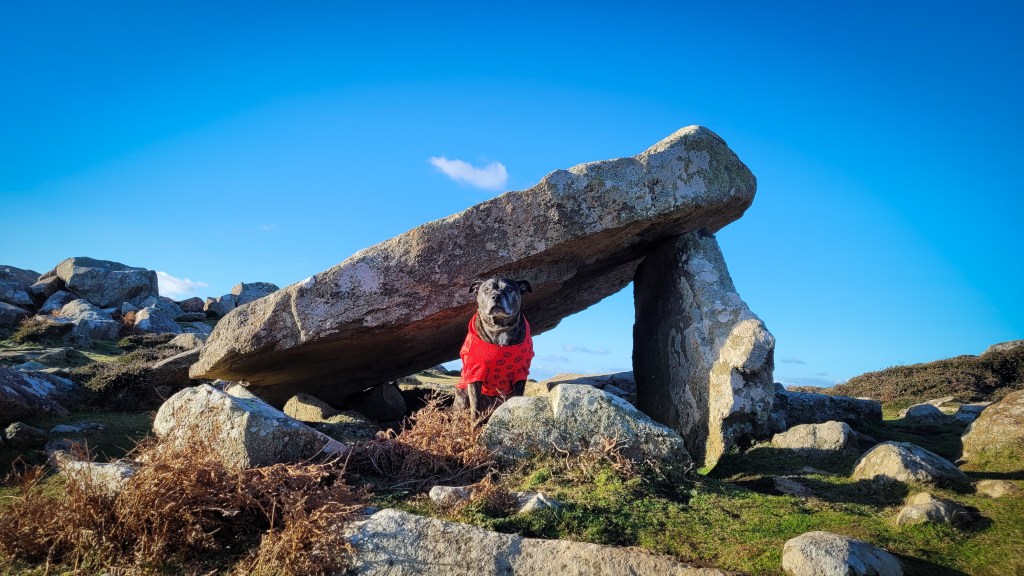
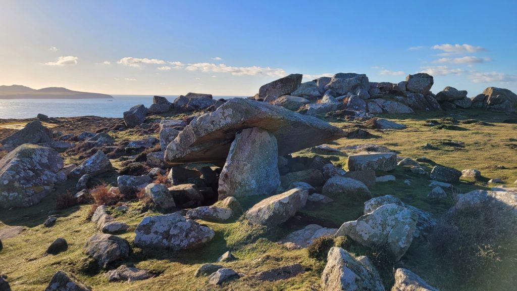
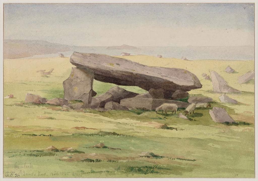
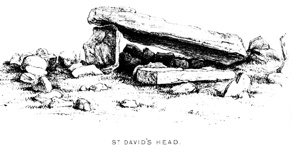
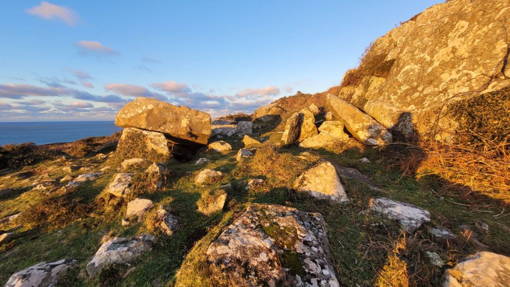
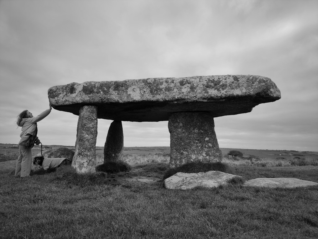
This cromlech sits on a stunning slice of the Pembrokeshire coast.. Boasting views as far as the mountains of Ireland on a clear day.
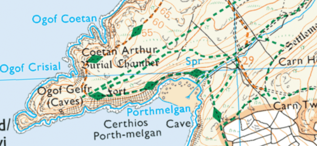
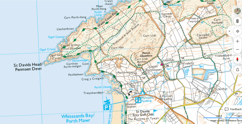
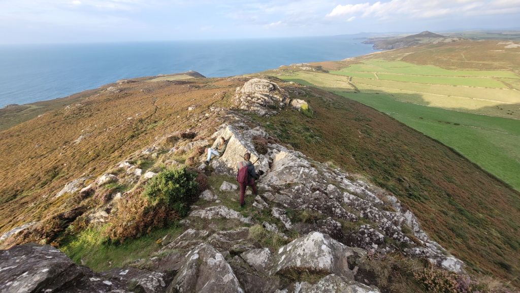
To reach the site we park at Porth Mawr (Whitesands Bay) and walk the Welsh coastal path toward St David’s Head at the base of Carn Llidi. As you ascend the marshy hills, the silhouette of Coetan Arthur begins to emerge..
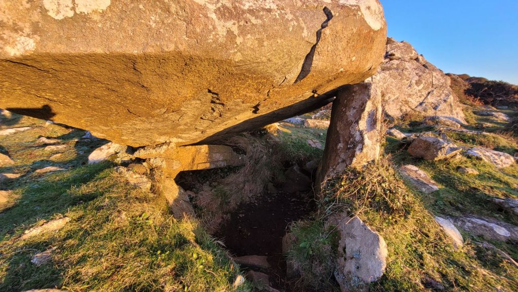
This cromlech is estimated to be from around 3000 BCE, 5000 years old. It’s capstones measures approximately 20 ft by 8 ft, resting now on only one upright, around 1.5m tall.
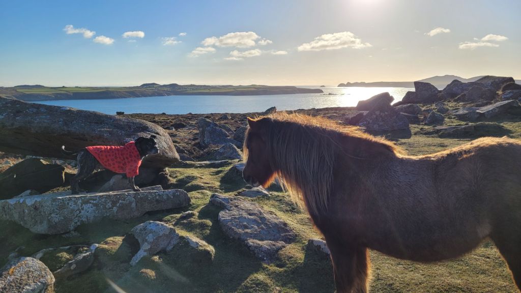
Our journey to this incredible site was made even more magical thanks to the presence of the enchanting wild mountain ponies. These ponies, with their resilience and beauty, add a touch of untamed nature to the surrounding hills.
As we were sat beneath the cromlech, soaking in the echoes of history.. one particularly curious pony felt obliged to come say hello to Zeb.
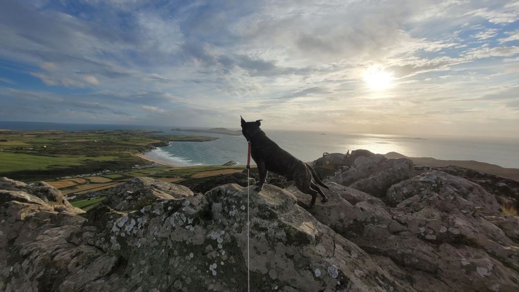
St David’s Head:
On St David’s Head is the promontory fort of Clawdd y Milwyr, or The Warrior’s Dyke.. Within the walls of the fort are the outlines of several round houses.. each house lying on a terrace cut into the slope and defined by numerous earth-fast boulders. In 1898 Baring Gould excavated six of these houses. He reported floors and heaths and found pottery, blue glass beads, spindle whorls and stone artifacts said to be from a Romano- British period..
“Essentially it consists of a dry-stone wall running along the western crest of a low valley side from Porth Melgan in the south to Porth Llong in the North enclosing an area of c. 24 ha including Clawdd y Milwyr promontory fort and Coetan Arthur chambered tomb.
Two enclosures lie over or close to the wall. Both are marked ‘hut circle’ on the 1889 OS 1:2500 1st Ed map. The southern enclosure is clearly not a hut circle. It is located on a shelf on the rock outcrop, and is constructed of loose, randomly laid rubble. It uses part of the rock outcrop in its circuit, and measures 15m by 8m. It has clearly been built over the levelled remains of the defensive wall. Baring Gould’s excavation of this enclosure revealed ‘much charcoal evidently the fireplace’, and two artefacts, a blue glass bead and a perforated stone, both of which might be of late prehistoric or Romano-British date. Slight traces of a possible pen lie on the ground below this enclosure. The northern enclosure is a possible candidate for a hut. Again the construction technique is of loose, randomly laid rubble, this time producing an enclosure 9m by 5m internally, built against the eastern face of the defensive wall. There are slight traces of a gap through the wall at this point, so this enclosure may have guarded a postern. A similar enclosure had been built over the collapsed remains of the wall immediately to the east. Baring Gould stated that this was a hide constructed for shooting sea birds in the mid 19th century.
K Murphy 15 June 2006” – https://www.dyfedarchaeology.org.uk/wp/wp-content/uploads/pemsm72sm82.pdf
Sabine Baring Gould’s sketch of the hut circles 1898 https://howardwilliamsblog.wordpress.com/2016/08/11/clawdd-y-milwyr-the-warriors-dyke/
“Inside the fort walls is a relatively level area at the foot of a rocky outcrop that occupies the tip of the headland. There are very obvious outlines of 6 hut circles on this level area, with partial outlines of several more. Six of the hut circles were excavated by the prolific Victorian archaeologist and vicar Sabine Baring Gould in 1898. Unfortunately, like many Victorian antiquarians, Gould’s methods of rough-and-ready excavation made it almost impossible for modern archaeologists to make sense of the site. Gould found a large number of spindles, used in weaving, and also stones used to grind grain and to scrape hides. Gould’s findings suggest that the hut circles were occupied during the Roman period. Gould also reported that ‘As a place of refuge in the face of an enemy, it must have been well-nigh impregnable. It was secure from the sea .. A direct assault on the strong rampart would be a forlorn hope if the wall was sufficiently manned’.”
Sir Richard Colt Hoare in 1793 in his Journal of a Tour of South Wales, writes of St. David’s Head..
“No place could ever be more suited to retirement, contemplation or Druidical mysteries, surrounded by inaccessible rock and open to a wide expanse of ocean. Nothing seems wanting but the thick impenetrable groves of oaks which have been thought concomitant to places of Druidical worship and which, from the exposed nature of this situation, would never, I think, have existed here even in former days. There is a singular lusus naturae in the rocks which project towards the sea on the most westerly point of land; which forms the perfect profile of a venerable of head such as I could have fancied a Druid’s character.” – https://archive.org/details/journeysofsirric0000hoar/page/47/mode/1up?view=theater&q=st+david
Here is our video in which we visit Coetan Arthur and explore the history of St David’s Head –

Leave a comment