
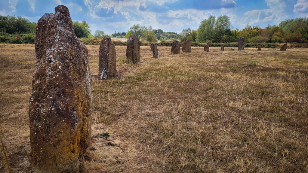

The Devil’s Quoits is a reconstructed prehistoric stone circle and henge near Stanton Harcourt in Oxfordshire.. The henge is of Late Neolithic date, although there is some uncertainty about the relative dating of the stone circle and the central stone setting. Both may have been constructed in the Early Bronze Age, after the henge had been in use for some time.
The henge ditch enclosed a sub-circular area up to 120 metres across, and featured opposed entrances to the east-south-east and west-north-west. Excavation of the ditch terminals indicated repeated use and deposition, with finds including hearths, animal and human bones.
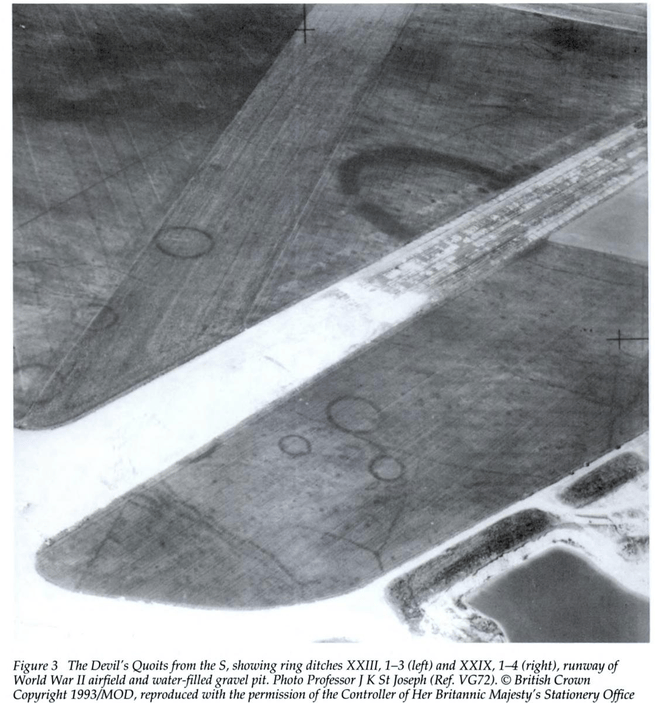
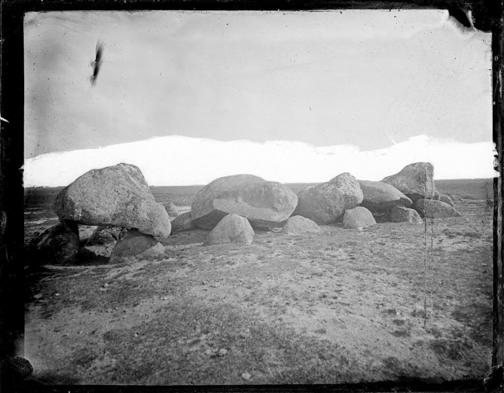
By the end of the medieval period, either for iconoclastic or agricultural reasons, the majority of the stones had been removed. Had they remained they would have attracted more antiquarian interest, which no doubt, would have led to more objection to the airfield that was constructed over the site in 1940, by which time only one standing stone remained in situ. Records from the 18th century describe three stones remaining. Two of these had been re-erected nearby.
Mr Akerman, in 1858, records a story of how one of the stones was removed and then restored: “There is a tradition in the neighbourhood that the northernmost stone was once removed by and occupier of the land, and laid across a watercourse, where it served as a bridge over which waggons and carts for some time passed, and that it was restored to its old locality at the request of one of the Harcourt family. A groove in this stone, eight inches from the top, seven inches in width, and about three inches deep, is believed to have been caused by the wheels of the vehicles when it lay prostrate”.
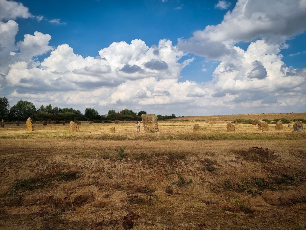
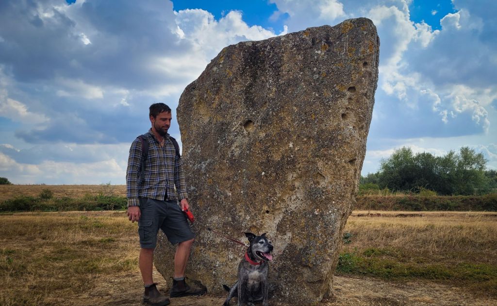
Between 2002 and 2008 the henge was restored and the stone circle re-erected, with three surviving original stones combined with other conglomerate stones found at the site. Twenty new replacement stones were placed in the original holes for a total of 28 stones.
The Excavations:
Grimes 1940 Excavation Report – https://www.oxoniensia.org/volumes/1943-4/grimes.pdf?
Excavations at the the Devil’s Quoits, Stanton Harcourt, Oxfordshire, 1972-3 and 1988 by Alistair Barclay, Margaret Gray and George Lambrick. Published in 1995 – https://books.google.co.uk/books?id=0NwWwmEdBD8C&printsec=frontcover#v=onepage&q&f=false
The following is quoted from the Geoconservation Newsletter, Summer 2022 issue:
“Oxfordshire Geology Trust designated the Devil’s Quoits as a Local Geological Site (LGS) because it provides an excellent opportunity to examine two different types of Quaternary River Terrace deposits; also, it is easily accessible for individuals and groups. Since its designation many visits have been organised and it provides a good educational site; possibly other groups might have similar examples that are a bit unusual. This site is close to the village of Stanton Harcourt and adjacent to Dix Pit; from the latter, extensive archaeo- logical finds dating from about 200,000 years ago have been recorded. The site is a henge and stone circle which was damaged by gravel extraction and the construction of a World War 2 airfield. It was restored using some of the original stones and new ones, from their nearby workings at Gill Mill, Ducklington, supplied by Smiths of Bletchingdon.
The original stones are a part of the gravels from the Summertown-Radley Terrace (that is, Terrace 2, dating from around 200,000 years ago). These gravels have been cemented together with an iron-rich cement. The clasts are mainly local Jurassic limestone but rounded quartz pebbles, brought from the Midlands by t he proto- Thames, are also present – as can readily be seen on the surfaces of the re-erected standing stones. The parish church of St Michael’s, dating from Norman times, in Stanton Harcourt also uses some of this conglomerate as a decorative course in one of its walls.
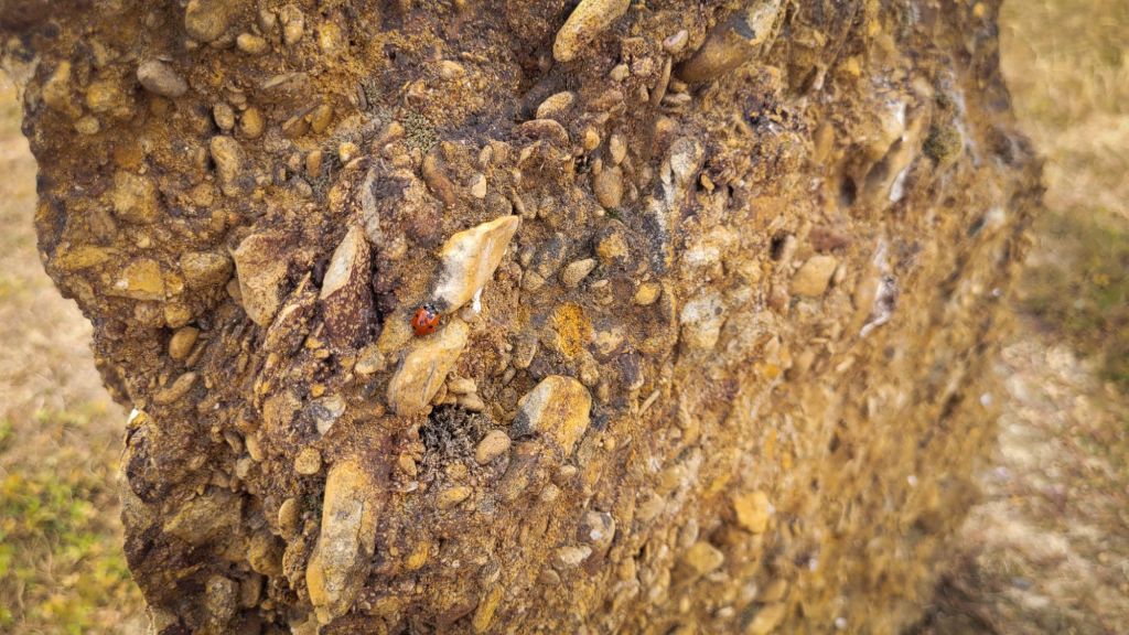
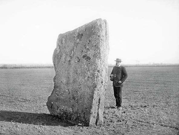
The new stones are from Terrace 1 and younger in age; they are less well cemented and so provide a good comparison between the two terrace deposits. They consist mostly of angular, platy clasts of locally derived limestones in a clay matrix. Their loosely cemented iron-rich conglomerate is weathering much more quickly than their Terrace 2 deposit counterpart. Although it would have been one of the most important standing stone circle sites in Britain, by the end of the 19th century only three of the stones were still standing and surrounded by ploughed fields; a photograph taken in the 1880s shows one of these about 2.5m high.
The site was briefly archaeologically excavated in the 1940s just before the three stones were pulled down to make way for a wartime aerodrome, the runway of which cut straight through the monument. After the war, a large part of the adjacent site was excavated for gravel. Further archaeological excavations were carried out in 1972-3 and then again in 1988 and these showed that once there were more than 30 stones in a 75m diameter circle with a 2m ditch and outer henge bank surrounding them. The stone circle is now thought to be between 4000 and 5000 years old. It is only partly a Scheduled Ancient Monument.
After use as a waste recycling site, the area was restored with the object of allowing public access to the Devil’s Quoits for the first time in more than 60 years. Engineering company Wardell Armstrong were asked by Waste Recycling Group to provide advice on the restoration. The task was to rescue any remaining stones and to re-erect them in the locations known from the archaeological record to have contained them. The remaining stones were to be supplemented by new stones of the same geological type obtained from a quarry at nearby Ducklington. The task included assessing safe founding conditions, designing suitable foundations and supervising the lifting and positioning of the stones within the site to methods accepted by English Heritage, working in close liaison with their assigned archaeologist.
The massive henge earthwork was rebuilt in March 2002. Some of the original stones were piled up in November 2003. In October 2005 some of the original stones were moved into position and new stones were erected to replace lost ones. The fully restored monument was opened in 2008.” – https://geoconservationuk.org/wp-content/uploads/2023/08/geonews-spring-2022.pdf
Legends and name:
The following is quoted from ‘A Handbook for Travellers in Berks, Bucks and Oxfordshire’, published by John Murray (1860): “At a short distance form the village are the disconnected stones known as the Devil’s Quoits, which are said to be memorials of a battle of Bampton, fought in 614, when the Saxon princes Cynegil and Cwhicelon slew more than 200 Britson ; but the name arises from the popular tradition that the Devil played here with a beggar for his soul, and won by the throwing of these huge stones. There is a belief in the village that, its name arose from the face that, when a battle was fought there, the general rode up to one of his captains, named Harcourt, who was in the thick of it, and called out “Stan to ‘un, Harcourt! Stan to ‘un, Harcourt!” and that Harcourt won the battle, and the place has been called Stanton Harcourt ever since.” – https://archive.org/details/bub_gb_vkcjAAAAMAAJ/page/n202/mode/1up?q=devil+quoits
The stones are also mentioned in ‘Stray Notes on Oxfordshire Folklore’, compiled by Percy Manning (1902):
“The Devil’s Quoits at Stanton Harcourt are three large standing stones, which are all that remain of what was probably a circle considerably larger than that at Avebury, and which doubtless gave their name to the neighbouring village (Stanton = A.S. Stantun, the stone enclosure). Beacon Hill is a very conspicuous landmark, just above Eynsham Bridge, on the Berkshire side of the Thames, about two and a half miles in a straight line from the ‘Quoits’. It is very steeply scarped on three sides, and it has been suggested that it was the British fortress of Egonesham, captured by the Saxons under Cuthwulf in 571.
The devil was playing quoits on Beacon Hill on a Sunday, and in a rage at being told it was wrong, he threw these three to where they are now.
One of the quoits standing in Walker’s Field was once taken away, and put over a ditch called the ‘Black Ditch’ in the ‘Farm Close’ to make a bridge ; but it was always slipping, and although often put back, it would not rest, and they were obliged to at last take it back to where it now stands. Wheel marks can still be seen on it.
Mr Akerman, in 1858, records a rationalised version of the same story, as follows: “There is a tradition in the neighbourhood that the northernmost stone was once removed by and occupier of the land, and laid across a watercourse, where it served as a bridge over which waggons and carts for some time passed, and that it was restored to its old locality at the request of one of the Harcourt family. A groove in this stone, eight inches from the top, seven inches in width, and about three inches deep, is believed to have been caused by the wheels of the vehicles when it lay prostrate”.
Joseph Goodlake of Stanton Harcourt, aged 63, in March 1901, gave me the following particulars which he had from his father: “When the war was in England, the fighter ended at Stanton by those stones, and from there across to Stanlake Down by Cut Mill. Harcourt was the general; he was Emperor in England; he is buried in the church with his sword and gun and clothes.” Further: “When the was was in England the officers used to hide behind them” (The Devil’s Quoits) “from the bullets,” and the men used to pick the bullets out of them when my informant was young.
The legend connecting the Quoits with a battle is confirmed by a story told by Tom Hughes: “An old man in that village told me that a battle was fought there, which the English were very near losing, when the general rode up to one of his captains, named Harcourt, who was in the thick of it, and called out “Stan to un, Harcourt, stan to un, Harcourt” and that Harcourt won the battle, and the village has been called Stanton Harcourt ever since”. – https://ia800805.us.archive.org/view_archive.php?archive=/13/items/crossref-pre-1909-scholarly-works/10.1080%252F0015587x.1899.9720480.zip&file=10.1080%252F0015587x.1902.9719315.pdf
Historical records:
The first mention of the Quoits in the literature appears to be from John Aubrey. He describes the site in the 17th century in his Monumenta Britannica, saying: “In Stanton Harcourt field in Com. Oxford southward from the Towne stand two great stones, called the Devil’s Coytes : sixty-five paces distant from one another. The east stone is nine foot high, and as much broad : halfe a yard thick. The west stone is eight foot high and about six foot broad, 1/2 yard thick. Two or three Bowshotts from hence is a great Barrow.” He adds a footnote: “One of these stones was taken down by a farmer about the year 1680 to make a bridge of”.
Robert Plot (National History of Oxford, 1705) thought that the Devil’s Coits were ‘Appendices’ to the barrow, ‘but that they seem a little too far removed from it.’
Gough’s edition of ‘Camden’ (1769), quotes Aubrey as the authority for part of his account, which however varies in important details : “In the fields of Stanton Harcourt stood three great stones called the Devil’s Coits, 65 paces asunder, but one of them was taken down several years ago to make a bridge. The thirds stone was smaller than the rest, and stood between the barrow and the church…”
J. Y. Akerman, in ‘Ancient Limits of Wychwood Forest’, 1858, enlarges upon the tradition of the removal of the northernmost stone : it “was once removed by an occupier of the land and laid across a water-course, where it served as a bridge over which wagons and carts for some time passed… it was restored to its old locality at the request of one of the Harcourt family. A groove in this stone, eight inches from the top, seven inches in width, and about three inches deep, is believed to have been caused by the wheels of vehicles, when it lay prostrate”.
In Thomas Hearne’s Collections, vol.III, 1888 p.403, it is stated that the barrow is in a “stony field”.
 CoralJackz - That History Couple
Leave a comment